THE EXCELLENT NEW BOOK SWEDISH GRACE has this interesting sidebar:
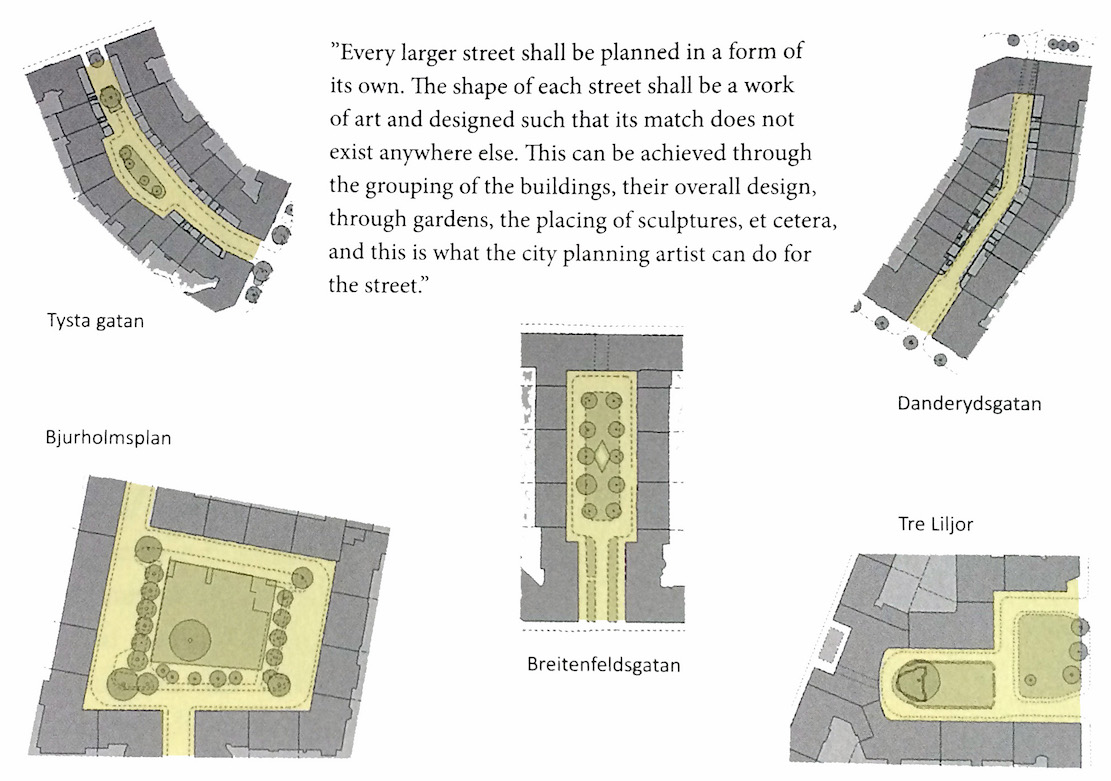 I’m just starting the book, but it looks great. And note that the streets that look like cul-de-sacs actually connect through the buildings to the next street.
Street Design: Buildings That Streets Go Through
Category Archives: Street Design
Bicycle Lane of the Day
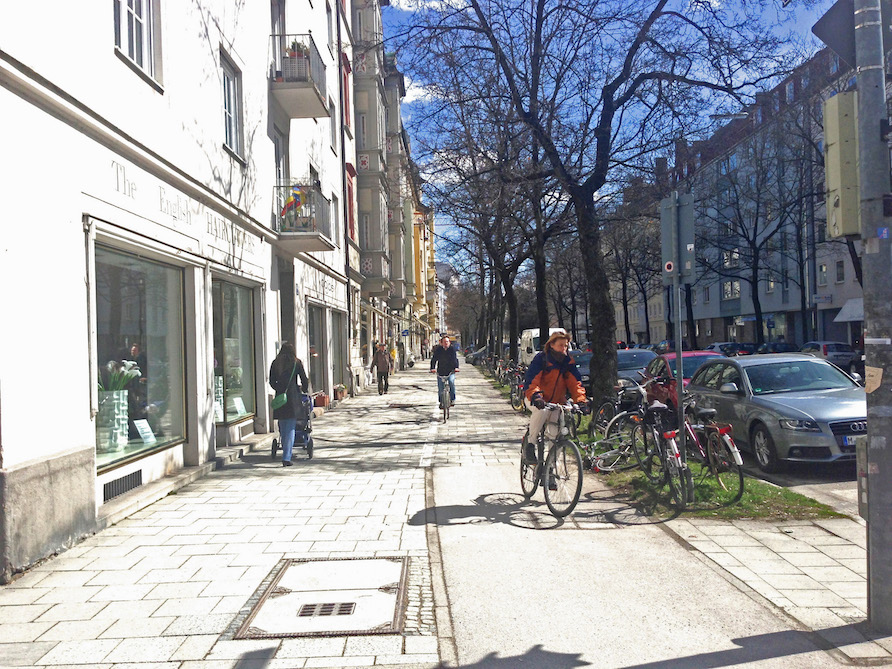
Franz-Joseph-Straße @ Kurfürstenstraße. Munich
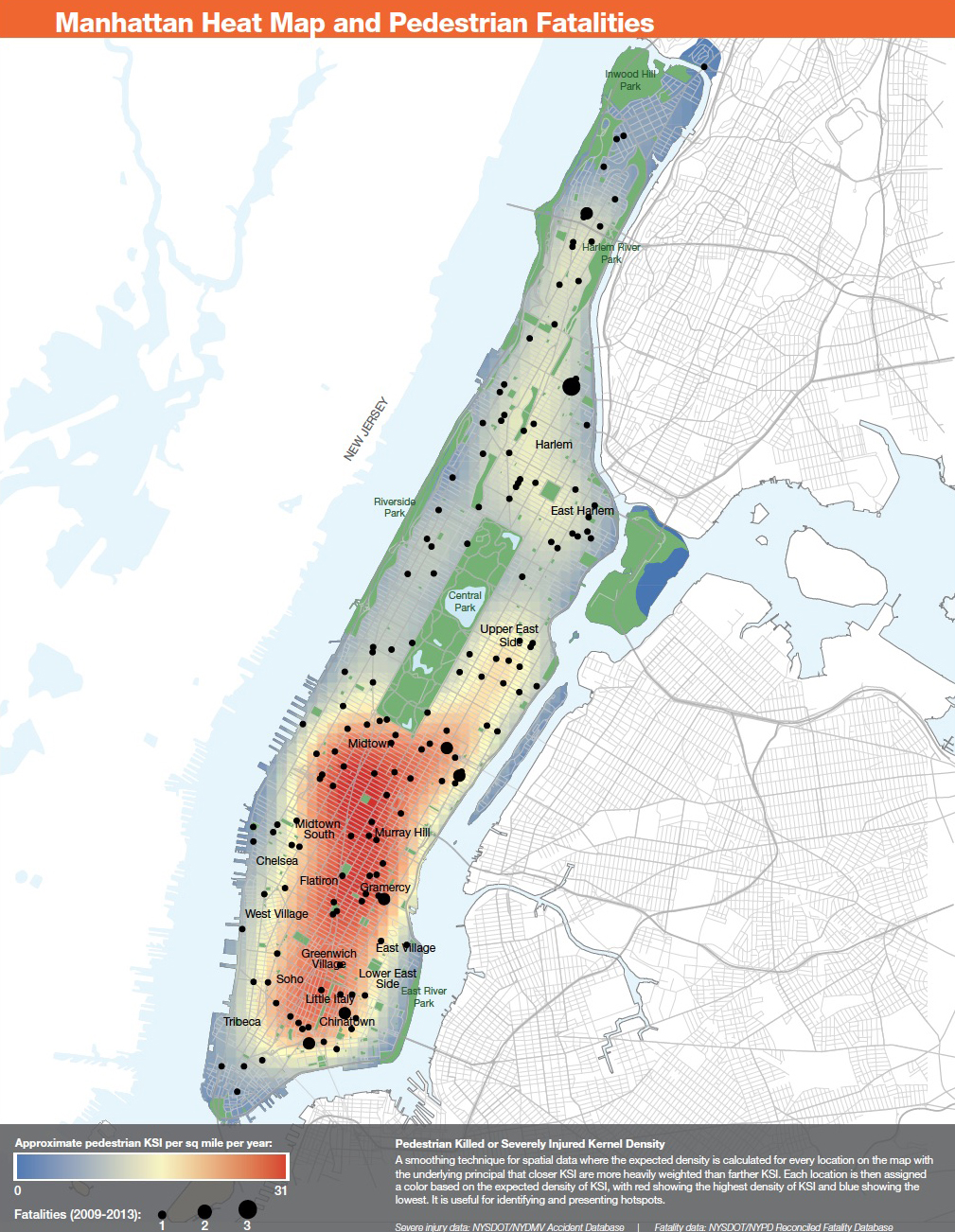
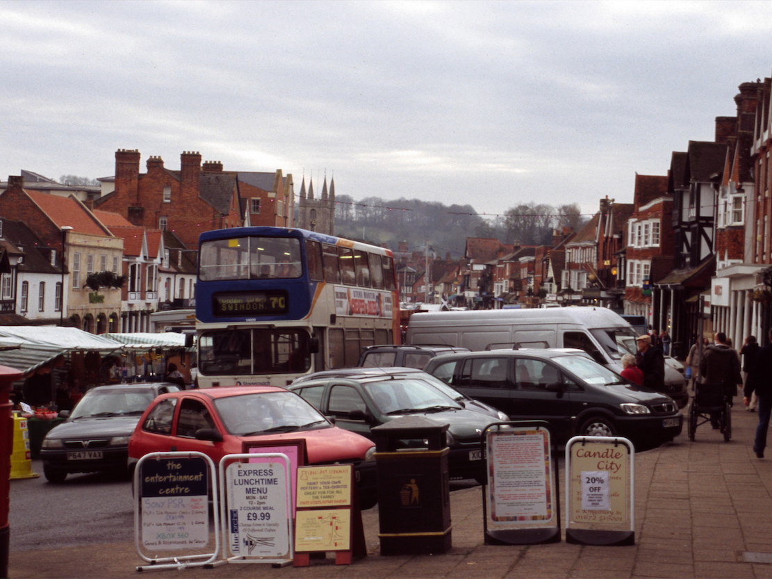
Map of the Day
THIS NEW MAP from the NYC DOT shows where pedestrians are killed in Manhattan. The overwhelming majority of the deaths happen to city residents who don’t own cars, to workers in the Manhattan who used public transit for their commute, or to tourists who arrived by plane, bus, or train.
If we had fewer people driving, and all people driving slowly, we could cut those deaths to zero. #VisionZero
“All the great cities and towns are congested”
“All the great cities and towns are congested” is an urbanist trope that needs to be retired. It comes, I believe, from arguing against traffic engineers when they talk about Level of Service rather than observing the best places.
I was in London the day their Congestion Zone started. I was staying in a hotel on High Holborn, a major through street that continues Oxford Street (or vice versa, depending on where you’re coming from). The Central Line on the London Underground was undergoing repairs and wasn’t operating.
The day before the congestion zone started, Oxford Street and High Holborn were jammed even more than usual with buses, taxis, trucks, and cars. You could walk any distance long or short in either direction from Oxford Circus or Tottenham Court Road and know that walking would be faster than taking a bus. They were traveling along stuck nose to tail in traffic. The problem was the speed the buses were going, not time spent waiting for a bus.
That day traffic flowed like water in an oversized pipe. It was so pleasant, and such a pleasant contrast to the day before. It was the way cities should be. You could walk without being buffeted by noise and diesel smell, and you didn’t have to wait at every crossing for traffic to pass by.
Slow Street of the Day — the rue Norvins in Paris
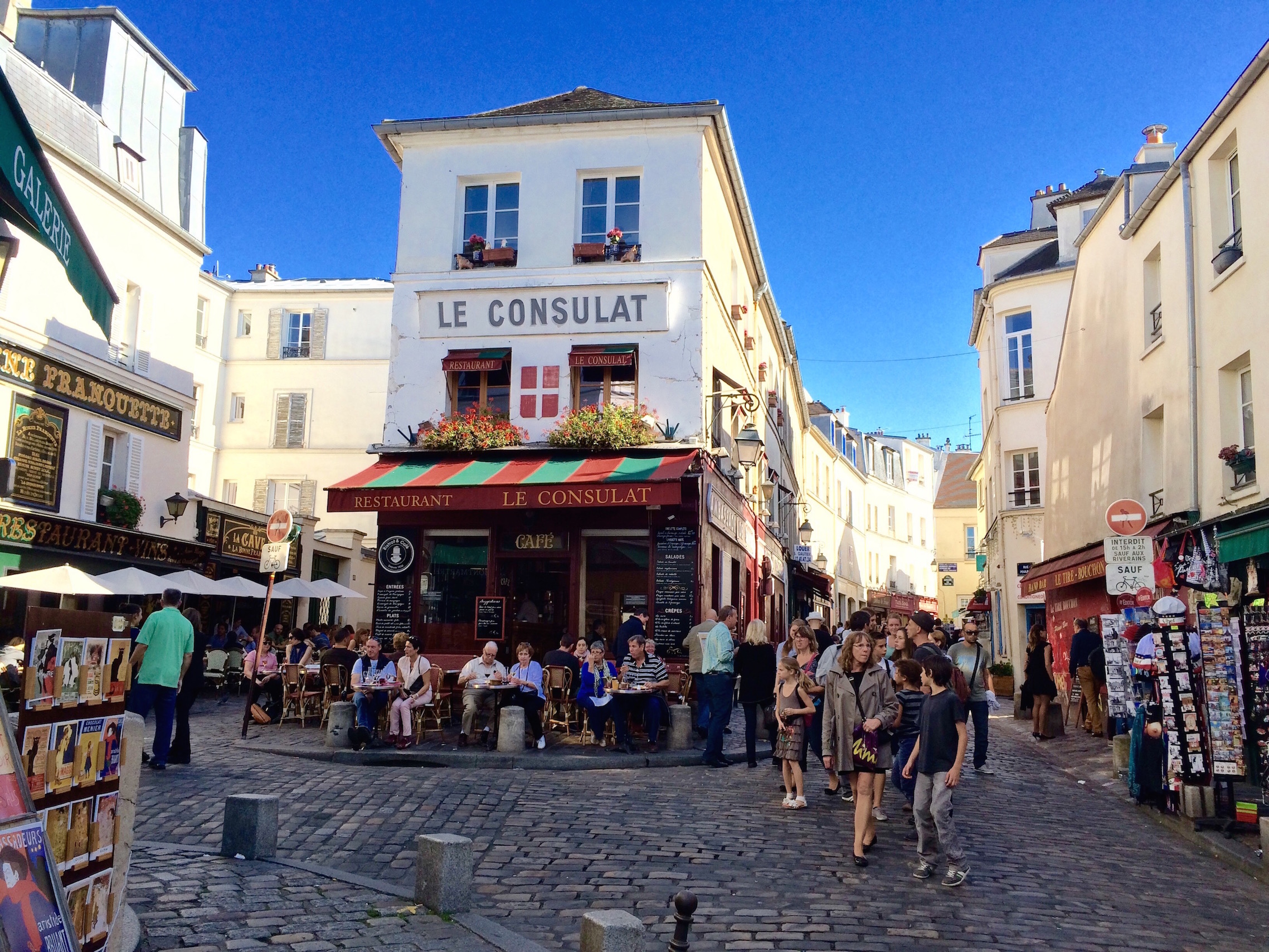
Photo courtesy of Galina Tahchieva @ DPZ
ALMOST ALL STREETS IN PARIS now have speed limits of 20 or 12.5 miles per hour (30 or 20 kph). The rue Norvins in Montmartre was already slower than that. Why? Not because of a city-set speed limit or police enforcement, but because of the natural design speed of the street.
The narrow roadway, the poor lines of sight, the rough cobblestones, the unforgiving stone bollards at the edge of the street, the lack of traffic signs (there’s only one, which limits cars to those belonging to residents between 3 pm and 2 am), and most of all, the free-range pedestrians in the middle of the street—these all produce a space that makes drivers unacomfortable driving quickly.
English authorities are introducing a number of shared space streets there. I haven’t seen most of them, so I can’t say much about the Sea of Change film that makes the proposal that new shared space streets in England are frequently unsafe for the blind and disabled. That’s obviously an important issue—if we are going to make slow streets that use slow speed and a lack of the traffic engineer’s separation of car and pedestrian to make safer streets, then we need to make them safer for everyone.
Continue reading
Buildings That Streets Go Through

More streets posted at photos.massengale.com.
Also see Separated At Birth: One Santa Fe & One Western Avenue
All the Streets Illustrated in Street Design
AN ALPHABETICAL LIST of all the streets illustrated in Street Design. You can also download a sortable Excel list by clicking here.
Air Street. London, UK
Alta Vista Terrace, Chicago, IL
Arcade Santo Stefano, Bologna, IT
avenue d’Iena, Paris, FR
avenue de l’Opéra, Paris, FR
avenue Foch, Paris, FR
avenue Montaigne, Paris, FR
Aviles Street, St. Augustine, FL
Avinguda Diagonal, Barcelona, ES
Continue reading
Affordable Housing & The Boulevard of Death Followup

STREETSBLOG published this great image of a 1914 proposal for Queens Boulevard from the Queens Chamber of Commerce. They also linked to a recent project for the Boulevard by a group called Planning Corps. I hadn’t seen either of these projects before (although I know one of the founders of Planning Corps, and saw some of their base data), but it’s good to know that in both 1914 and 100 years later multiple groups and public processes came up with similar ideas.
We know the ideas are enduring and popular.* So, can we build them now?
Second, there are differences in how we might build it today. The belief that maybe Organized Motordom isn’t always right gains more and more supporters, along with still-evolving concepts like Slow Streets and Shared Space. The conceptual images we made for Transportation Alternatives show slow lanes along each side of the boulevard that are very different than the ones shown above. The distance from the buildings to the center traffic lanes are similar (maybe even identical), but the Chamber of Commerce image still gives more room to the cars and less to the pedestrians.
Slow Street of the Day
 Via della Dogana Vecchia, Rome
Click on the image for larger version
HANS MONDERMAN AND SHARED SPACE are all the rage, but the Italians starting making slow streets in the late 1960s without naming them. Rome and Bologna don’t have all the traffic-calming bicycles that Amsterdam and Delft have, but the streets in the Centro Storico of Rome are still shared-space slow streets, with very few of the signs and markings that make drivers comfortable.